One of the best examples of this is the Hohtürli, a mountain pass in the Bernese Alps. My friend and I decided to do this hike in September 2009. My friend, who lives in Switzerland, has over the years done most of the stages of the Via Alpina, a multi-stage hike across Switzerland that traverses 14 different passes in the Swiss Alps. One of the passes he had not yet done was the Hohtürli, the highest pass (at 2778 m) along the Via Alpina, between the village of Griesalp and the town of Kandersteg.
We met in the Bern train station on a cloudy weekend, and after a bit of confusion and some running, we got on the BLS train to Reichenbach im Kandertal, where we transferred to a PostBus. In fact, there were two PostBuses going to Griesalp, our destination, and we ended up on the smaller one, and this would be important shortly. Both buses followed the same route into a valley called the Kiental, but after awhile we ended up at the base of what looked like a cliff. Our bus continued on, while the people on the larger bus had to get off, and board a smaller bus waiting for them. We soon discovered why, as our bus wound its way up the forested cliff along a very narrow, switch-backing road, at one point squeezing between two huge rock faces. After some ascent, we arrived at the trail head in Griesalp. I later learned that this was apparently the steepest bus route in Europe!
It was still misty when we left Griesalp, so unfortunately we did not get the grand views we were hoping for, but the panoramas from the village were still beautiful:
We marched up into the mist, eventually rising above the tree line. Here we were greeted by Alpine pastures clouded in mist and covered with marmots! Never had I seen so many marmots in the wild, all in one place, making their little marmot noises. We continued to ascend, and the path steepened:


Finally, the clouds broke and we saw some blue sky and mountains:

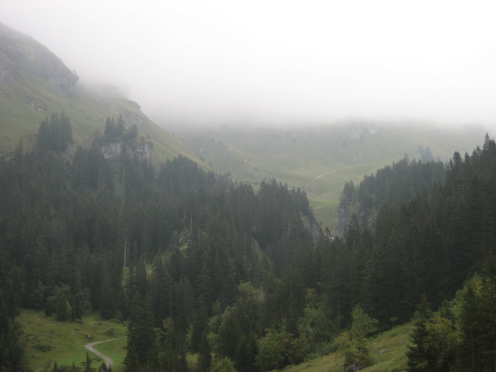
Unfortunately, the clear skies did not last, and the final push to the Hohtürli was made in mist:


That last stretch nearly killed me, I think, as the path got so steep that steps, and in some places chains or railings, were put in place. But then we finally made it!

Because of my friend's murderous pace, we had reached the top in three hours, a climb of 1400 m from Griesalp. But as it turned out, the descent was steep and just as hard:

Even though the sign at the top said Kandersteg, our destination, was only 3 hours, 15 minutes away, it proved a much slower slog. Still, the terrain along the way was rugged, wild, and breathtaking, and included even more marmot sightings:


After having a bite to eat while sitting on a glacier-deposited boulder, we made our way towards a mountain lake called the Oeschinensee. At this point, our legs were like rubber, so we were looking forward to taking a chairlift down from the Oeschinensee to Kandersteg, saving ourselves an hour of walking and 400 m of steep descent. We were forced to make another steep descent along a cliff face over the lake, and by the time we reached the resort area on the shores of the lake, the chairlift had stopped for the day :( We pushed through another hour and finally reached Kandersteg, dead-tired, but excited that we had conquered the Hohtürli. This was easily the hardest hike I had done in Switzerland: steep climbs and ascents, an elevation gain to the pass of 1400 m and a drop from the pass to Kandersteg of almost 1800 m, all over a distance of about 15 km. All told, it took us around 7.5 hours, including a couple breaks to eat. And while I still wish the weather had been clearer, it was one of the most rugged and memorable hikes I enjoyed while living in Switzerland.
If you want to do this stage of the Via Alpina, check out the official route from Wanderland.ch. Highly recommended!
Good times!! :)
ReplyDeleteIn retrospect, it seems even more awesome, given the contrast between those photos and what I see on an everyday basis living in a large city nowadays.
ReplyDelete