Showing posts with label Switzerland. Show all posts

Saturday, April 30, 2011

Z is for Zermatt

I struggled with Z, not because it was hard to think of a topic, but because I had two really good topics: Zurich, Switzerland's largest city and home to many of my friends there; and Zermatt, the famous ski resort town at the base of the iconic Matterhorn.  I finally opted for Zermatt because people seem to enjoy my mountain pictures :)

I visited Zermatt four times during my four years in Switzerland, not an inconsiderable number given that each time it was a day trip, and it takes over three hours (one way) to travel from Lausanne to Zermatt.  I actually did not spend much time in Zermatt itself, because it is something of a Swiss tourist mecca, perhaps only matched by Interlaken, and after six months of living in Switzerland, I stopped feeling like a tourist.  Instead, Zermatt was the starting point for three very memorable hikes, and one memorable train ride on the Gornergratbahn with my mom.

To reach Zermatt from Lausanne, you take the InterRegio to Visp (if you are lucky, you can occasionally catch the faster Cisalpino on its way to Milan), then switch to the Matterhorn Gotthard Bahn traveling south to Zermatt.  The train climbs up near three-quarters of a mile in altitude (in some places using cogs to handle the incline) as it travels through the Mattertal, finally ending in Zermatt:

The Matterhorn looms above Zermatt

Trip #1: August 2007

Two of my good friends visited me in Switzerland, and I suggested we go to Zermatt and see the Matterhorn.  The weather in Switzerland, particularly in the mountains, is fickle, so I woke up at 6 am on a Saturday to check the webcam for the Matterhorn.  When I saw it was blue skies and no clouds, I roused my friends, we hustled to the train station (stopping for some delicious croissants at a nearby bakery), and away we went.

We were fortunate, for though it was August, the previous week had been rainy and cold, so the mountains above Zermatt were newly dusted with snow.  We did a classic hike, starting at Sunnegga (2288 m), an underground funicular ride up from Zermatt, past three lakes -- the Stellisee, Grindjisee, and Gruensee -- to Riffelalp.  I have many pictures of the hike, but this is forever my favorite:

The Matterhorn, reflected in the clear waters of the Stellisee
We have lunch by the Stellisee, and a light snack near at a restaurant near the Gruensee, where the waitress was impressed by the fact that my friend ordered a full liter of Coke (Er hat eine grosse Durst, I told her).


Trip #2: August 2009

It would be two years later that I would return to Zermatt.  This time, two more friends (both Americans, but living in Lausanne and working at EPFL) joined me.  We had decided to tackle the steep climb from Sunnegga to the Unterrothorn, topping out at over 3100 m above sea level.  The weather report forecasted early clouds, but by the time we arrived, I hoped they would clear.  When we arrived in Zermatt, the clouds hid everything, including the Matterhorn, and we were very disappointed.  Nonetheless, we took the funicular up to Sunnegga, hoping we might get above the clouds.  Even up there, however, the clouds still obscured everything.  We resigned ourselves to finding a shorter, less scenic hike, but as we were studying the map, I turned around and saw this:


Within 30 minutes, the Matterhorn looked like this:


With suddenly blue skies and snow-capped mountains welcoming us, we began the steep ascent to the Unterrothorn, culminating in a rocky, exposed trek along the Ritzengrat:


Finally, we reached the top, and were rewarded with 360 degrees worth of views:


Trip #3: October 2009

In the fall of 2009, my mom visited me in Switzerland.  She was very lucky because we had one week of glorious weather, a truly rare feat in Switzerland.  Towards the end of her trip, I think she was getting a bit tired with crisscrossing the country (though it is her fault on insisting we go to Liechtenstein), but I told her that the weather was great and she would not forget a trip up into the mountains above Zermatt.  This time, we went to Zermatt not for a hike, but to take the Gornergratbahn up to Gornergrat, a station at 3100 m complete with a shopping mall!  But the best part of Gornergrat are the views: 


Trip #4: July 2010


My last visit was a grand hike up to the Hohbalmen, an alpine meadow high above Zermatt, with fantastic views of glaciers and mountains all around.  The hike consists of two parts: a traverse up a stream bed called the Triftbach, and then a climb up to the Hohbalmen itself.  This hike took me to the other side of the valley, somewhere I had not been before above Zermatt.

The Triftbach
At Trift, below the Gabelhorn Gletscher
Hohbalmen, with a view of the Matterhorn
After reaching the Hohbalmen, we were originally going to hike to a point called Zmutt, but instead we decided to call it a day and make the incredibly steep descent to Zermatt.

Like I said, I could do without the town of Zermatt, but it is the launching point for numerous incredible hikes in one of the most picturesque locales in the Swiss Alps.  That wraps up the A to Z Blogging Challenge here on Occam's Samurai Sword, I hope you enjoyed it!

Wednesday, April 27, 2011

W is for Walensee

I've already mentioned my two favorite lakes in Switzerland (is it weird that I have such a ranking?), the Vierwaldstättersee and the Oeschinensee, but today I am going to talk about another of my favorite Swiss lakes, probably #3 or #4, a lake called the Walensee.

The Walensee is located partially in the canton of Glarus and partially in the canton of St. Gallen, in the eastern portion of Switzerland, not far from Liechtenstein.  In fact, the first time I saw the Walensee was when I was traveling from Vaduz back to Zurich, and rode (by train) past the southern shore of the Walensee.  The view from the south shore is fantastic -- the Walensee is a long lake, and the northern shore is more cliff than beach, and beyond the cliffs rear up the Churfirsten, a range of mountains:

A view of the Churfirsten, from the north side of the lake
The moment I saw it, I knew I wanted to hike along the north side of the lake, and a few years later I finally did.  It was November 1, 2009 (I remember the date because the day before, on Halloween, I hiked up to the top of Monte San Salvatore in Lugano), and I met up with friends in Rapperswil.  We took a train and then a bus to the village of Amden, and then proceeded to hike most of the length of the lake, from Amden to another village called Walenstadtberg.  For the beginning of November, the weather was almost summer-like -- a really perfect autumn day for a late season hike.


One of the best parts is that we finished up in Walenstadtberg just as darkness was falling, and stumbled upon a small restaurant, which ended up being more a person's living room and kitchen than anything else.  The proprietor and a few of her friends were celebrating the anniversary of the restaurant, and they welcomed us in without hesitation.  About 45 minutes later, we caught the PostBus down the mountain and returned to Zurich.

Tuesday, April 26, 2011

V is for Vinho Verde

I was going to write about the Vierwaldstättersee, my favorite lake in Switzerland:


Instead I am going to discuss the virtues of vinho verde (literally "green wine" in Portuguese).  Vinho verde is a type of wine produced in the Minho region of Portugal.  It is called green wine because of how young and refreshing the wine is, though the most common varieties are white wines that may possess a slightly greenish hue.  In fact, I later learned that there are white, rosé, and red varieties of vinho verde.  Because of its youth, you tend to drink it within a year, and the alcohol content (in the white wines at least) are lower, around 9-11% abv.  It is not quite a semi-sparkling wine, but there is a hint of fizziness, which just adds to the refreshing character of the wine.  Vinho verde enjoys official name protection and pretty much exclusively denotes wines produced from certain grapes following certain guidelines in a region known as Entre-Douro-e-Minho.

I was first introduced to vinho verde on, of all days, my 30th birthday.  My friends and I gathered alongside the lake in Lutry for an evening picnic, and one person brought a bottle of Gazela vinho verde.  I really enjoyed it, and as coincidence would have it, I was leaving early the next morning to go to a conference in Porto.  Now, you would expect that I would drink a lot of port while in Porto (and I did), but my beverage of choice in the warm Portuguese summer was vinho verde.  As far as I am concerned, no wine is better enjoyed in hot weather or accompanying fresh seafood.  Porto had an abundance of this in Matosinhos, where restaurants line the sidewalks selling freshly caught and grilled fish (particularly sardinha assada, grilled sardines).  Actually, I could spend a whole blog post just waxing poetic about the fish in Matosinhos.

I have yet to try rosé or red vinho verde, but with the weather growing warmer here in Philadelphia, I certainly plan to.  If you have never had vinho verde, I suggest you take the opportunity this summer to do so.  It makes a great aperitif or, as I have said, pairs well with simply prepared grilled fish (whitefish mostly) and shellfish.  I have tried a few producers -- Gazela, Casal Garcia, and Aveleda are the ones I can remember -- and have not been disappointed.  And vinho verde is inexpensive, so taking a flier on a bottle hardly requires an investment.  Check out the official Portuguese webpage (in English) for much more information about vinho verde. 

Thursday, April 21, 2011

R is for Rigi

Rigi is one of the most famous mountains in Switzerland.  It is called Die Konigin der Berge ("Queen of the Mountains"), though it is barely over 1500 m high.  Instead, I think the draw of Rigi is its location -- towering above the beautiful Vierwaldstättersee and Zugersee in central Switzerland, with a 360 degree panoramic view that lets you see many of different parts of the Swiss Alps.

I had wanted to visit Rigi for sometime, and finally had the chance in the fall of 2009, when my mom visited me in Switzerland.  We got really lucky and enjoyed five days of glorious weather.  We spent one of those days taking the train from Lausanne to the city of Arth-Goldau in the canton of Schwyz.  From Arth-Goldau we took a rack railway up to the top of Rigi, where we could look in every direction and see something spectacular:

Pilatus to the west
The view southwest towards the Berner Oberland
A close-up of the Berner Oberland, including Jungfrau, Monch, and Eiger

The Schilthorn, made famous in the James Bond film "Her Majesty's Secret Service"
The view east of the Glarner Alps
The southeastern view of the Urner Alps
After we had our fill of the views (if that is even possible), we took the train down the other side to the town of Vitznau, where we took a boat across the Vierwaldstättersee (which, with all due respect to the Oeschinensee, is my favorite lake in Switzerland) to Luzern, one of my favorite cities in Switzerland.

Monday, April 18, 2011

O is for Oeschinensee

A Swiss friend told me that he thought the Oeschinensee ("Oeschinen Lake" in German) was the most beautiful lake in Switzerland.  What do you think?


 That picture does not even show you the coolest feature of the lake, which I shall reveal in time.  After having the endorsement of a Swiss citizen, I decided to visit the Oeschinensee in the summer of 2008 (I would later return, under much cloudier conditions, during the Hohtürli hike).  As it turned out, the forecast for the day I picked was beautiful in the morning, with increasing clouds in the afternoon, so I hopped a very early train to Bern and switched to the BLS line to Kandersteg.  Kandersteg is situated in the beautiful Kandertal:


From Kandersteg I took a chairlift up about 400 m to a path leading to the Oeschinensee:


Instead of following everyone straight to the lake, however, I took a path that veered up towards the mountains surrounding the lake -- my goal was to walk above the lake to its far end, then descend quickly and walk at lake level when I finished my circuit.  Following this path (and hilariously giving directions in Germans to other hikers, even though I knew next-to-nothing about the trail), I would catch glimpses of the lake through the trees, but finally I reached a point far enough up to see it in its entirety:

The most dramatic feature of the Oeschinensee is not its turquoise color, or the surrounding snow-capped mountains, but the sheer cliff, which is probably 300 m tall, at one end of the lake.  I continued my way along, getting more beautiful views of the lake and surrounding mountains.


The farthest point of my hike was a mountain restaurant, where I had some sausage and leek soup, and from there I descended rapidly among cows happily lounging in the sun (a pretty common sight when hiking in Switzerland):

Finally I was back at lake level, and hiked the flat path along the Oeschinensee and back to the chairlift, just as the clouds started to roll in.  Perfect timing!

Overall, it is a relatively short hike, unless you link it up with something else, but the scenery is magnificent.  There are a number of hikes that start or finish in Kandersteg as well, several gems in Swiss hiking, including the famous Gemmipass.  I highly recommend visiting the lake, even if you do not hike around it. 

If you want to see more pictures of the Oeschinensee, check out my photo set.

Friday, April 15, 2011

M is for Mondeuse

When two friends visited me in Switzerland in August 2007, we immediately took a weekend trip to nearby France, driving from Geneva to the wine region of Savoie.  It is a little-known region, with many mountains and massifs (Albertville, host of the 1992 Winter Olympics, is in Savoie) and rare but wonderful wines.  The second place we visited was nothing more than a man's garage, where he stored the wine he produced and offered tastings.  He spoke French, we spoke English, and my own French was terrible (and still is), but I remember trying a red wine called Mondeuse that he said was "plus rustique", and that has stuck with me.  For some reason -- perhaps because of all the ancillary memories of visiting the beautiful valleys of Savoie -- I now have a fondness for Mondeuse, and try to have it whenever I notice it, which is not particularly often, since it primarily a grape grown in Savoie, and they are not a large producer by any definition.  The wine itself is deep and dark red, full-bodied, and like the man said, has a rustic taste and feel to it -- it is not refined like some red wines, but it is very enjoyable to drink.  I think it goes well with hard cheeses and meat dishes.

The second time I had Mondeuse was in Switzerland, in a restaurant in Lausanne.  They had a bottle of Mondeuse produced in nearby Mont-sur-Rolle, a really beautiful wine-growing town west of Lausanne, in the region called La Cote.  This particular bottle, produced by the Domaine de Maison Blanche, was blended with pinot noir (the most popular red wine grape in Switzerland), which mellows the flavors and makes it smoother in the mouth (don't put too much stock in this description, I don't know what I am talking about).  As an aside (and still letter M appropriate!), visiting Mont-sur-Rolle is highly recommended if you are going to be near Geneva, particularly during a special weekend called Caves Ouvertes ("open cellars"), where the producers open up their businesses (oftentimes their homes) and encourage people to come in and taste the newest vintage.

If you happen to see a bottle of Mondeuse (or red Vin de Savoie, it is likely made with this grape) wherever you are, give it a try.  And let me know where you found it :)

Thursday, April 14, 2011

L is for Lutry

I had many options for L, nearly all of them Swiss-centric: Lausanne, Luzern, Lugano, Locarno, Lac Leman, the Lavaux...but I had to decide on just one.  So I picked my favorite place in Switzerland: Lutry.

Lutry is a small town east of Lausanne, situated in incredibly picturesque surroundings on the northern shore of Lake Geneva (Lac Leman in French).  It lies on the western edge of the Lavaux wine region, recently named a UNESCO World Heritage Site.  When you look to the east, you see the beautiful terraced vineyards of the Lavaux (pictures courtesy of my friend, since I sadly have no pictures of Lutry for some reason):


When you look across the lake, you can see France and the Alps:


Along the lake there is an excellent stand for ice cream.  And the town itself is beautiful -- an old church and narrow alleys are just what you expect of a medieval European town.  All of these aspects factor into why Lutry is my favorite place in Switzerland, but the most important factor is the Caveau de Vignerons ("wine-growers' cellar).  I was introduced to the caveau not long after I arrived in Switzerland by two of my closest friends there.  As you can tell from the pictures, Lutry is situated near vineyards, but in truth there are vineyards within the borders of the town itself (including right by its train station).  Wine is a big part of the town's identity.  The caveau is, as the name suggests, collectively owned by all the wine-growers in Lutry (basically a cooperative) and serves only wine made in the two appellations in the Lutry region: Lutry and Villette.  The caveau is run by two people (who are not wine-growers) named Pascal and Francoise.  We got to know Pascal very early on, as he speaks English and is wonderfully friendly, and taught us much about Lavaux wines (I will keep the topic of Swiss wines for another time).  The caveau is a popular hang-out for locals, situated in an old cellar-like room, now decorated with photos and art and sporting tables made out of large wine barrels:

(Source: montreux-vevey.com)

If you look very carefully, there are a ton of plush monkeys hanging over the bar -- that is because monkeys are the symbol of Lutry.  Anyway, my friends and I spent many hours in the caveau, drank many bottles of wine, and it was a favorite destination for all of us to bring visiting friends and family members.  In the summer we would bring plastic cups, grab a bottle of chasselas (a white wine), and sit by the lake drinking before retiring to the caveau for the inevitable bottles of red wine.  In September we would all come to Lutry for La Fete des Vendanges, the festival celebrating the grape harvest.  On one of my last days in Switzerland, I visited the caveau and told Pascal I was leaving, and he gave me a bottle of pinot noir made in Lutry.  He told me to save it for a day when I missed Switzerland.   I miss Switzerland often, but so far I have kept the bottle in a safe place.

Saturday, April 9, 2011

H is for Hohtürli

Prior to living in Switzerland, I had done a little bit of hiking, but never as a regular activity.  In Switzerland, hiking became something I really enjoyed, and I looked forward to the start of hiking season every spring.  One of the best things about Switzerland is that hiking is very civilized.  What does that mean?  You can hike high into the Alps, be surrounded by snow-capped mountains, glaciers, and rugged, rocky terrain, and yet only be an hour away from civilization.  Many of the best hikes I did in Switzerland included fantastic mountain restaurants part way through the excursion, at the highest points of the hike! 

One of the best examples of this is the Hohtürli, a mountain pass in the Bernese Alps.  My friend and I decided to do this hike in September 2009.  My friend, who lives in Switzerland, has over the years done most of the stages of the Via Alpina, a multi-stage hike across Switzerland that traverses 14 different passes in the Swiss Alps.  One of the passes he had not yet done was the Hohtürli, the highest pass (at 2778 m) along the Via Alpina, between the village of Griesalp and the town of Kandersteg.

We met in the Bern train station on a cloudy weekend, and after a bit of confusion and some running, we got on the BLS train to Reichenbach im Kandertal, where we transferred to a PostBus.  In fact, there were two PostBuses going to Griesalp, our destination, and we ended up on the smaller one, and this would be important shortly.  Both buses followed the same route into a valley called the Kiental, but after awhile we ended up at the base of what looked like a cliff.  Our bus continued on, while the people on the larger bus had to get off, and board a smaller bus waiting for them.  We soon discovered why, as our bus wound its way up the forested cliff along a very narrow, switch-backing road, at one point squeezing between two huge rock faces.  After some ascent, we arrived at the trail head in Griesalp.  I later learned that this was apparently the steepest bus route in Europe!

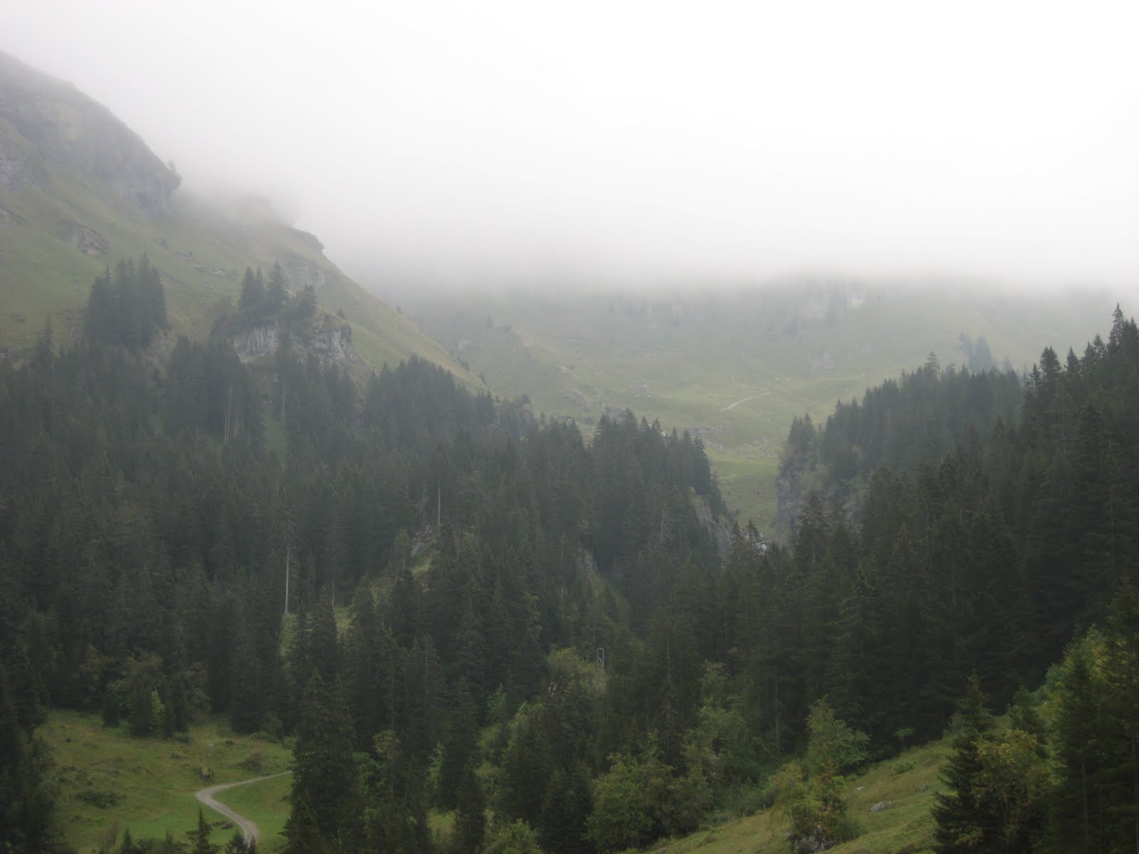
It was still misty when we left Griesalp, so unfortunately we did not get the grand views we were hoping for, but the panoramas from the village were still beautiful:


We marched up into the mist, eventually rising above the tree line.  Here we were greeted by Alpine pastures clouded in mist and covered with marmots!  Never had I seen so many marmots in the wild, all in one place, making their little marmot noises.  We continued to ascend, and the path steepened:


Finally, the clouds broke and we saw some blue sky and mountains:


Unfortunately, the clear skies did not last, and the final push to the Hohtürli was made in mist:


That last stretch nearly killed me, I think, as the path got so steep that steps, and in some places chains or railings, were put in place.  But then we finally made it!


Because of my friend's murderous pace, we had reached the top in three hours, a climb of 1400 m from Griesalp.  But as it turned out, the descent was steep and just as hard:


Even though the sign at the top said Kandersteg, our destination, was only 3 hours, 15 minutes away, it proved a much slower slog.  Still, the terrain along the way was rugged, wild, and breathtaking, and included even more marmot sightings:


After having a bite to eat while sitting on a glacier-deposited boulder, we made our way towards a mountain lake called the Oeschinensee.  At this point, our legs were like rubber, so we were looking forward to taking a chairlift down from the Oeschinensee to Kandersteg, saving ourselves an hour of walking and 400 m of steep descent.  We were forced to make another steep descent along a cliff face over the lake, and by the time we reached the resort area on the shores of the lake, the chairlift had stopped for the day :(  We pushed through another hour and finally reached Kandersteg, dead-tired, but excited that we had conquered the Hohtürli.  This was easily the hardest hike I had done in Switzerland: steep climbs and ascents, an elevation gain to the pass of 1400 m and a drop from the pass to Kandersteg of almost 1800 m, all over a distance of about 15 km.  All told, it took us around 7.5 hours, including a couple breaks to eat.  And while I still wish the weather had been clearer, it was one of the most rugged and memorable hikes I enjoyed while living in Switzerland.

If you want to do this stage of the Via Alpina, check out the official route from Wanderland.ch.  Highly recommended!

Friday, April 8, 2011

G is for Grosser Aletschgletscher

The Aletsch Glacier (Grosser Aletschgletscher or "Great Aletsch Glacier" in German) is the largest glacier in the Alps, measuring over 20 km in length.  It is located within the Swiss Alps Jungfrau-Aletsch UNESCO World Heritage Site in southern Switzerland.  And hiking to and along the glacier is one of my favorite hikes in all of Switzerland -- in fact, I enjoyed it so much that I did some variation of the hike three times.   My favorite version of the hike starts up in the mountains, after a cable car ride up to a small resort village called Fiescheralp.  From Fiescheralp, you start hiking around a mountain peak called the Eggishorn.  About 30 to 45 minutes into the hike, you are greeted by this view:


Beautiful, am I right?  But the best part is, this isn't even the Aletschgletscher; this is the smaller, nearby Fieschergletscher.  A little bit farther into the hike, you move through an alpine valley, and eventually reach the Grosser Aletschgletscher: 

I took that picture myself!  Pretty amazing, isn't it?  And my meager photography skills do not even begin to capture the majesty of the glacier, or the beauty of the surrounding mountains.  That view is pointed towards a place called Konkordiaplatz, where three different smaller glaciers come together to form this one massive river of ice.  If you get down right next to the glacier, you can actually climb on it, and check out a small lake called the Märjelensee, which is filled with ice:


You continue to walk above the south edge of the glacier, enjoying an ever-changing view.  If you are lucky, you might even see some marmots!


Finally, after six hours, you end up in another mountain resort town called Bettmeralp:


This hike is extremely popular with the Swiss and tourists alike.  It is not too difficult, though it is quite long, but if you are already planning on visiting Zermatt and seeing the Matterhorn, the Aletschgletscher is only 1.5 - 2 hrs away, and worth it.  Here are my pictures from 2006, 2008, and 2009, and if you are interested in doing the hike as I described, I recommend this description from Activity World.

Wednesday, April 6, 2011

E is for École Polytechnique Fédérale de Lausanne

The École Polytechnique Fédérale de Lausanne (EPFL) is one of two Swiss Federal Institutes of Technology, sharing that honor with the more famous Eidgenössische Technische Hochschule Zürich (ETHZ).  Situated on the shores of Lake Geneva, in Lausanne (the capital of the French-speaking canton of Vaud), EPFL is a world-class research university, with strengths in engineering, architecture, and life sciences.  EPFL has over 7,000 students; at the undergraduate level, the vast majority of students are Swiss, but at the graduate level, there are many international students.  The international flavor of EPFL is further reflected in its faculty -- more than 50% are from outside Switzerland.  All told, according to EPFL, there are 107 nationalities represented on campus.  EPFL is consistently ranked among the top universities in Europe and worldwide, particularly in the sciences and engineering, and yet I knew next to nothing about it when I moved there nearly five years ago.

For four years I was a post-doctoral fellow in the Laboratory of Mechanobiology and Morphogenesis, which later became the Laboratory of Lymphatic and Cancer Bioengineering, part of the Institute of Bioengineering (effectively our department) within the School of Life Sciences.  As I said, I knew very little about EPFL, beyond the lab I was joining, and I was very impressed with the superb quality of research at EPFL, the facilities (which are second to none -- truly exceptional), and the international flavor of all the labs.  In our lab, for example, at one point we had over a dozen countries represented!  So in addition to doing great science, I had the chance to learn about other cultures without even setting foot outside the lab.     

What else is there to know about EPFL?  Well, from the cafeteria (which also serves alcohol) on top of the computer science building, you have an incredible view of the Alps.  You are a 15 minute walk from the shores of Lake Geneva and the beautiful lakeside village of St. Sulpice.  The university is home to the provocative and daring Rolex Learning Center, designed by the Japanese architectural firm and Pritzker Prize-winning SANAA.  The campus bar, Satellite, has a good beer selection, especially if you like Belgian brews.  And EPFL was a major consultant in the design of the America's Cup-winning Alinghi yacht.

Depending on your research interests, I would definitely recommend giving EPFL some consideration.  The experience of living and working in another country is incredibly valuable, and the quality of research at EPFL means you can gain this valuable international experience without compromising on your Ph.D. or post-doctoral training.  As you might learn as this A to Z challenge continues, Switzerland holds a special place in my heart, and my time at EPFL is an important part of that experience.

Monday, April 4, 2011

C is for Creux du Van

I lived in Switzerland for four years, and in those four years I explored the country extensively.  One of the places I visited frequently, because I lived relatively close by in Lausanne, was the Jura Mountains.  Everyone knows the Swiss Alps, but the Jura is the other prominent mountain range in Switzerland, running along the France-Switzerland border from Basel to Nyon (roughly).  And one of the most singular sights in the Swiss Jura is the Creux du Van:

 
I have read that it is the Grand Canyon of Switzerland (though that is normally reserved for the Rhine Gorge), but the Creux du Van is not a canyon at all; rather, it is a concave rock face or a cirque.  If you look at it using Google Maps, its dramatic shape is quite evident.  It sits in the canton of Neuchatel, in the Val-de-Travers (home of absinthe), and the pictures I took do not do it justice.  The hike up and down are strenuous (about a 700-800 m change in elevation, at times quite steep), though not too difficult -- we started and finished in the village of Noiraigue, and ascended past la ferme Robert and through forests to the top.  On the way down, we followed le sentier des quatorze contours, a series of switchbacks that quickly drops you back down to where you started.  If you live in Switzerland or nearby France and have not done this hike, or if you are going to be in Switzerland and want to do something other than hit up the Hard Rock Cafe in Interlaken, I highly recommend it.  The Val-de-Travers is a pretty neat place unto itself, where you can purchase absinthe, and visit a wonderful restaurant called La Truite that serves incredibly fresh truite au bleu, homemade absinthe ice cream, and local rosé wines.

For more info and some high quality topographical maps, check out the following links: